
Welcome to the map room

Darkness of winter days is but a fleeting memory replaced by bright nights. Cartographer dips the pen into the ink. First lines are drawn and the journey begins.
It is only fitting that the journey starts with maps. Mappa Mythica is framed by two maps. Both of these maps have a special meaning to me.
It was May 2024 and I had been living in Southern Finland for a bit over a decade. I went to see Karttoja, Kaukomaita ja kuviteltuja maailmoja (Maps, Distant Lands and Imagined Worlds) exhibition in Museokeskus Taika, Hyvinkää with my friends. I was immediately captivated by the beauty of incredibly detailed maps on display there. On closer inspection I found something very familiar in them: my hometown Tornio.
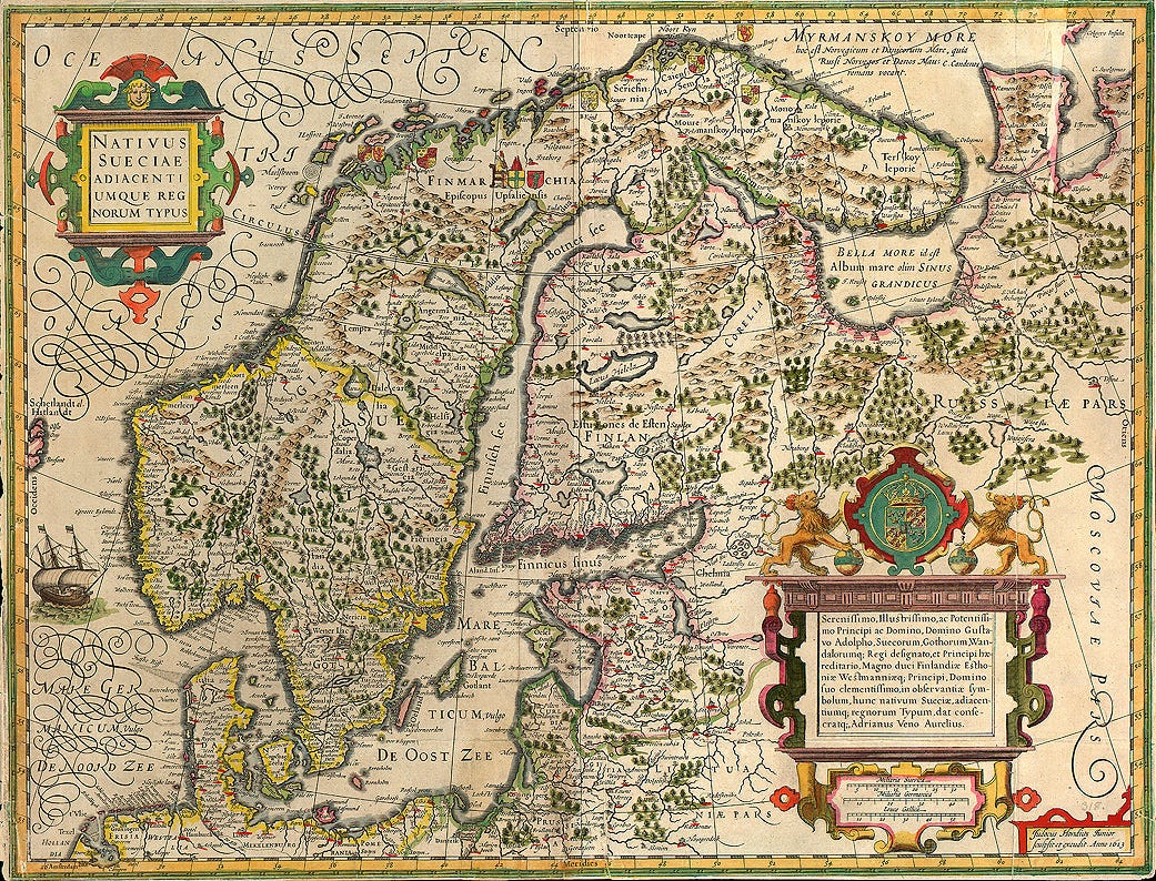
In the logo of Mappa Mythica you see part of Adrian Veen’s map Nativus Sueciae adiacentiumque regnorum typus (1613) centered on Tornio. I took a photograph of this map in the exhibition.
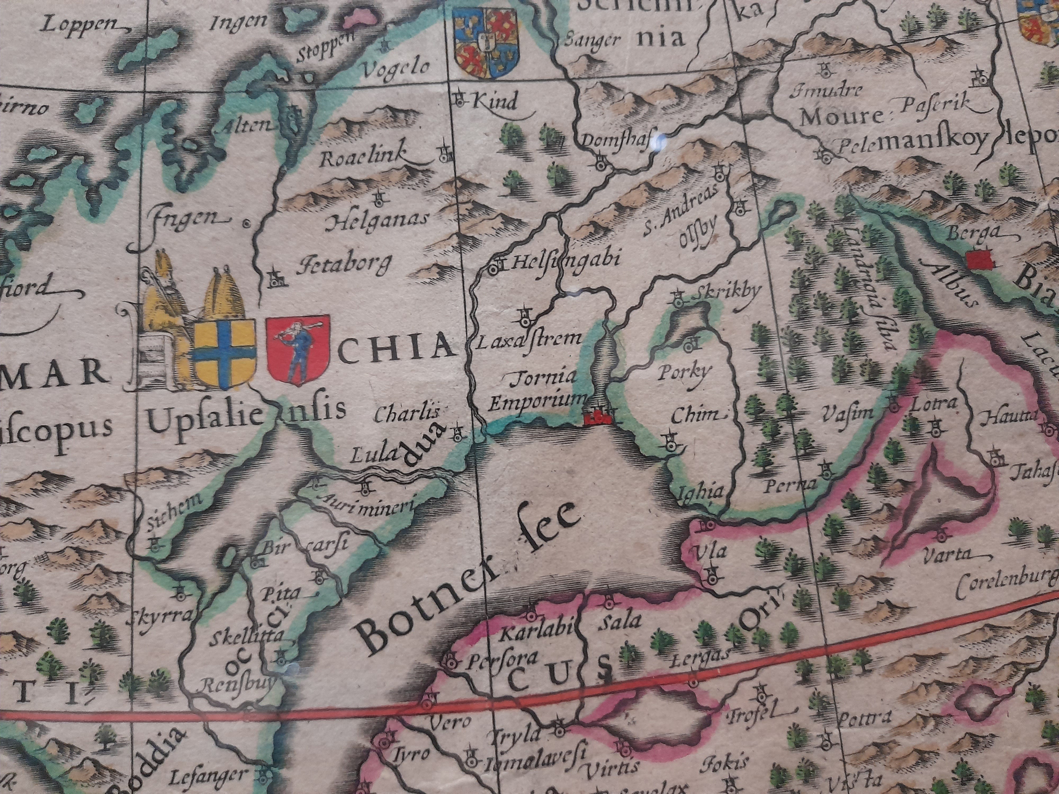
Veen’s map depicts Scandinavia and parts of Russia. It was engraved by Jodocus Hondius Jr. and published in Amsterdam in 1613. The map was dedicated to Gustavus Adolphus (Gustav II Adolf, 1594–1632), king of Sweden who turned Sweden into one of the great European powers of the time. Gustavus Adolphus also planted the seeds of Finnish land surveying by assigning Andreas Bure (1571–1646) to map areas that would later become Finland. Back in those days Finland was the eastern part of the kingdom of Sweden.
Veen’s map has been described as the best map of Scandinavia during its own time. It is also a beautiful display of skill with elegant details including Sweden’s coat of arms standing between two lions and a ship sailing at full sail.
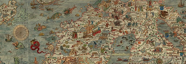
Nativus Sueciae adiacentiumque regnorum typus wasn’t the first map where Tornio was depicted. You can also find it in an older map: Olaus Magnus’ Carta Marina (1539).
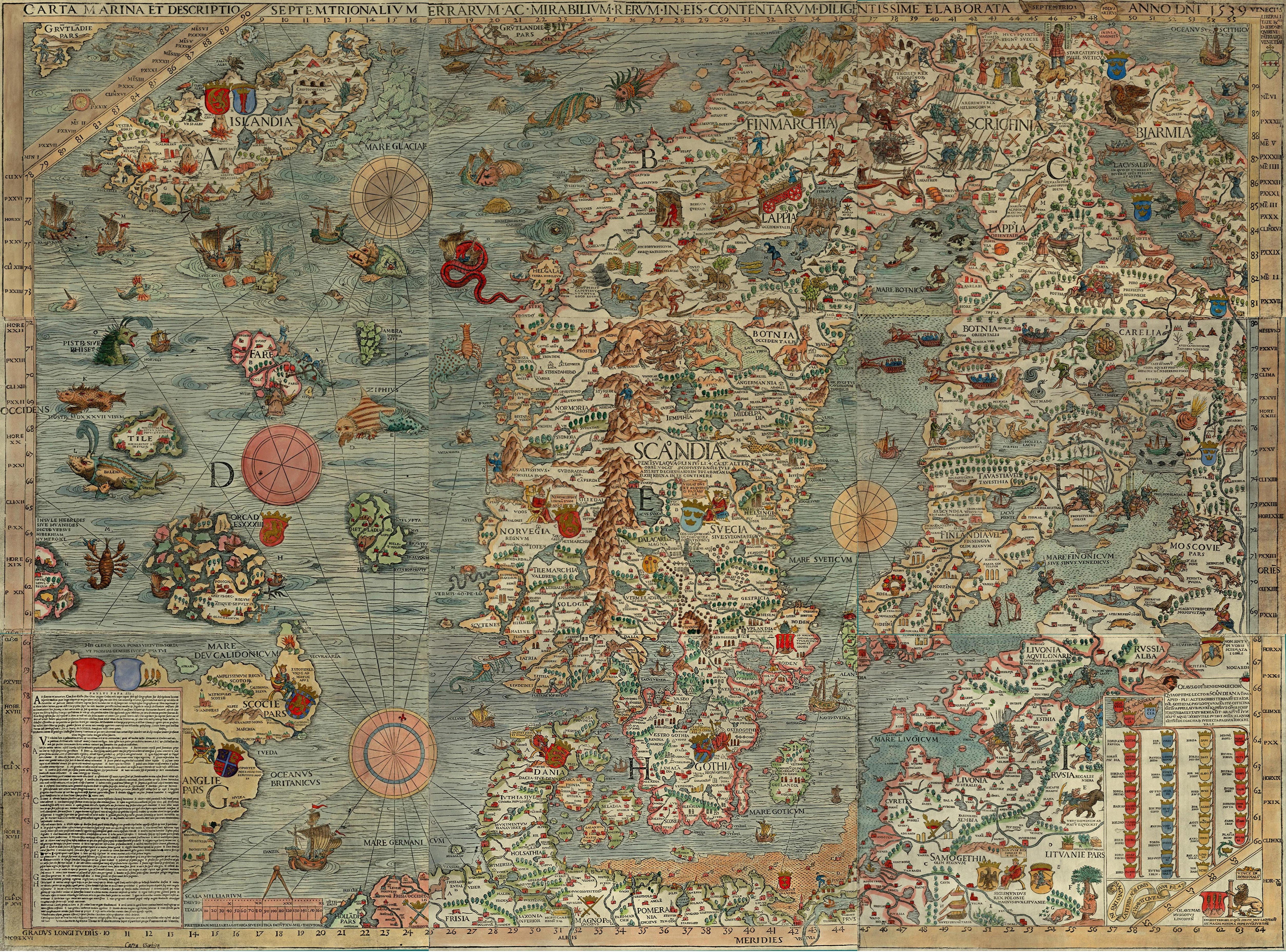
The banner of Mappa Mythica is a piece from this map centered on Tornio and surrounding areas.
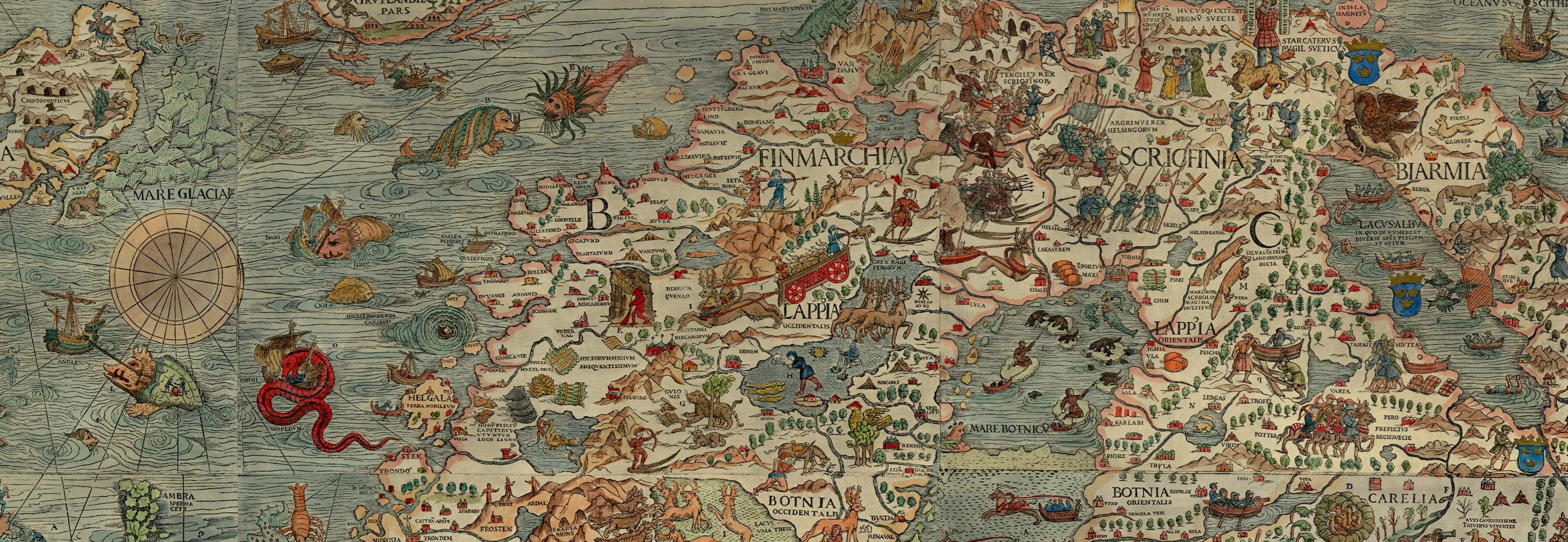
Carta Marina is the first map depicting Nordic countries more or less correctly. It also shows Baltic countries, Greenland and parts of British Isles and Russia. Carta Marina was printed on nine sheets in Venice in 1539. It was a huge map measuring about 170 x 125 cm. This ambitious project took twelve years to be completed by its cartographer.
The cartographer of the map was Olaus Magnus (1490–1557). He was a Swedish diplomat, cartographer, writer and Catholic clergyman. He was a learned man and traveled widely. In 1518–1519 he traveled in Sweden, Norway and Northern Finland. During his travels he observed salmon fishing in Tornio, which he described later as a prosperous region. Olaus Magnus continued his journey up the Tornio river all the way to Pello. He stood on the shore of the same river along which I grew up and charted previously unknown areas that now frame Mappa Mythica.
His travels helped him to chart the shores of Nordic countries more accurately than anyone before him (even though accuracy of inlands left much to be desired). His other sources for Carta Marina included earlier cartography, literature and tales of sailors.
Olaus Magnus didn’t create his map in Sweden. His good relationship with King Gustav I Vasa (1496-1560) soured during the Reformation when Sweden chose to embrace the Lutheran form of Christianity. Catholic Olaus Magnus didn’t have a place in Sweden anymore. He was exiled and his property in Sweden confiscated in 1530. Pope Paul III appointed him as the next Catholic Archbishop of Uppsala following the death of his brother, the also exiled previous archbishop Johannes Magnus (1488-1544). Thus Olaus Magnus became known as the last Catholic Archbishop of Uppsala, even though he was archbishop in name only. Due to the Reformation he wasn’t able to perform his duties or set foot in Sweden again.
Carta Marina, with its astonishingly detailed depictions of folk culture and fierce sea monsters, was the authority for cartographers seeking to map the North European seas for the next fifty years. The existence of some of the sea monsters came into question a hundred years later. But why was Carta Marina filled with sea monsters? Unlike in many other maps of the time, they were not only for decoration. Their task was to teach and warn sailors of dangerous waters during times when many lives were lost at sea.
Thus Carta Marina stands at the intersection of myth and reality where medieval spirituality meets empiricism of the Renaissance. And here stands also Mappa Mythica, field journal of the cartographer of mythologies. We begin our journey from the intersection of myths and reality, fantastic and mundane. You can expect posts and notes from the field journal twice a month from today onwards. Once again, welcome to Mappa Mythica.
Hic svnt dracones — here be dragons.
Piia